More From Contributor
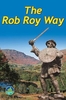
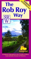
£6.99
Meet a little boy whose toy animal friends come to life at bedtime in this riotous, shout out loud picture book by Joshua George. Children age 3 & up will laugh out loud when the animals make the wrong noises... & join in with the noisy fun when they finally get them right. ...
Archived Product
£12.99
• Waterproof • Tear-Resistant • Fishing & River Map The Roaring Fork & Fryingpan Rivers Fishing & River Map Guide is designed to be the perfect companion to anyone recreating on either of these two iconic Colorado rives. The Roaring Fork begins at Independence Pass & passes through the towns of Aspen, Basalt, & Carbondale before finally joining the mighty Colorado at Glenwood Springs. Along the way, it covers 68 river miles & drops 6, 700 feet in elevation & morphs from a small mountain stream into a mighty & powerful waterway known as ” Thunder River” by the local Ute Indians struck by its imposing roar. Numerous recreational opportunities are available from fishing along the Rail-to-Trails converted Rio Grande Trail that follows the river for most of its length to running the class IV rapids just downstream from Aspen. The Fryingpan River is known primarily for its Gold Medal waters that start at Ruedi Reservoir Dam & continue all the way to the confluence of the Roaring Fork in the historic outdoor recreation town of Basalt. This guide covers the Gold Medal Waters of the Fryingpan for 14 miles & ends at Ruedi Reservoir. Each Fishing & River Map Guide

Includes::
detailed river maps at a scale of 1 inch = 1/2 mile. At this scale every turn in the river & rapid is clearly shown & labeled. Each page is centered on the river & overlaps with the adjacent pages so finding any location along the river is easy. The maps include rapids, river miles, access points, private & public lands, gaging stations, recreation sites, & more. Also included are stream flow charts, hatch charts, & a table of river access points. More convenient & easier to use than folded maps, but just as compact & lightweight, National Geographic`s Fishing & River Map Guide booklets are printed on ” Backcountry Tough” waterproof, tear-resistant paper with stainless steel staples. A full UTM grid is printed on the map to aid with GPS navigation.

...
Archived Product
£15.99
The author has spent 5 years travelling & eating in search of the tastiest dishes from the snowiest climes, resulting in an irresistible collection of dishes from North America & Northern Europe. This re-issue of a classic & unique collection of recipes celebrates some of the world's most overlooked cuisines by using produce that can be found on our own doorsteps. There are potato & cheese dishes from Italy's skiing slopes, pastries from the coffee houses of Vienna & Budapest, & little appetizers that have been eaten at Russian celebrations since the days of the Tsar. These recipes will bring warmth to your heart as well as your home. ...
Archived Product
£25.00
A mix of modern & traditional Greek recipes, all inspired by the quaint & picturesque island of Paxos. This cookbook will appeal to fans of Mediterranean cuisine as well as those inspired by Greek island life. On the sleepy & beautiful Ionian island of Paxos, the local people still follow the old ways. They cook from ancient recipes: simple dishes, handed down the generations until they seem to have become part of the collective unconscious u in which good ingredients are allowed to speak for themselves. The food on this little island is special, because by happy accident of history & geography, Paxos is the place where Greek & Italian cuisines meet. Here, you have the simplicity & robust flavours of traditional Greek food, lifted with Italian style & panache. The result is the quintessence of Mediterranean cooking
- healthy, fresh ingredients used in delicious flavour combinations that are easy to prepare. Try your hand at real Tzatsiki & tasty Dolmades; learn a fuss-free way to prepare grilled meats & seafood; cook up one of Belinda`s warm pies on a cold winter night, & mix a glorious daquiri for a warm summer evening with friends. How many times have you fallen in love with something you have tasted on holiday, only to be disappointed when trying to recreate it at home? Roast Lamb in the Olive Groves not only brings a treasure-trove of tastes home safely, it shows how these dishes can be made dazzling & inspiring for modern cooks to serve at home. In sparkling, original recipes that are true to the spirit of Paxiot cooking, it shows how the ancient can be very modern indeed.
...
Archived Product
£9.99
For the most popular of his Scottish romances, published at the end of 1817, Scott drew on the legends & historical anecdotes about Rob Roy Mac Gregor he had collected in his youth. The famous outlaw is only one of a series of vivid characters who cast their spell of the novel`s hero, Frank Osbaldistone, on his journey through the wild northern territories of the new United Kingdom. Banished from his father`s house, falling hopelessly in love with the spirited Diana Vernon, Frank becomes involved in he conspiracy surrounding the disastrous Jacobite rising of 1715. His adventures take him to ` Mac Gregor`s country`, across the Highland Line, where he finds cruelty, heartbreak, & some unlikely friends. By turns thrilling & comic, Rob Roy contains Scott`s most sophisticated treatment of the Scottish Highlands as an imaginary space where the modern & the primitive come together. Newly edited from the ` Magnum Opus` text of 1830, this edition

Includes::
full explanatory notes & a critical introduction exploring the originality & complexity of Scott`s achievement.ABOUT THE SERIES: For over 100 years Oxford World`s Classics has made available the widest range of literature from around the globe. Each affordable volume reflects Oxford`s commitment to scholarship, providing the most accurate text plus a wealth of other valuable features, including expert introductions by leading authorities, helpful notes to clarify the text, up-to-date bibliographies for further study, & much more.

...
Archived Product
£9.50
The Rob Roy Way, a 126 km/79 mile trail from Drymen near Loch Lomond to Pitlochry, at 1:40, 000 on a light, waterproof & tear-resistant map from Footprint Walks in their series covering long-distance hiking routes. The trail is presented on 11 overlapping panels, each designed to cover one daily stage, with mapping providing user-friendly yet comprehensive information about the challenges of the route, services along the way, places of interest, etc. The maps have contours are at 10 metres intervals with altitude colouring, plus additional colouring for woodlands. The route is clearly highlighted, indicating where it follows roads, tracks, cycle paths, footpaths or no visible paths, with mile markers &, where useful, possible danger signs. A range of symbols indicate various overnight accommodation options, cafes & pubs, grocery shops & ATMs, places of interest, etc. Each panel has British National Grid lines &

Includes::
route instructions plus a profile showing changes in altitude. The map also provides general information on local public transport, etc.

...
Archived Product
£11.99
The Rob Roy Way, a 124km/77 miles trail from Drymen near Glasgow to Pitlochry in the Scottish Highlands, presented by Rucksack Readers in handy A5 size, spiral-bound, waterproof guide with mapping at 1:110, 000. The guide provides general advice on when to go, availability of accommodation, etc, &

Includes::
notes on the region’s history, railway heritage, habitats & wildlife, etc. Detailed route descriptions, arranged in daily stages, are preceded by a summary of each section of the route giving distance, terrain, grade, side trips, & availability of food & drink. The guide is illustrated with numerous colour photos. The guide shows the route highlighted on fold-out flap of the cover at 1:110, 000. The map has altitude colouring to show the topography & also indicates various facilities & places of interest. No geographical coordinates for GPS users are provided. The publishers recommend as more detailed & GPS compatible coverage maps of the route from Harvey Map Services or Footprint, or the Explorer Series from the Ordnance Survey (4 maps). To see other titles in this series please click on the series link.

...
Archived Product
£13.95
Rob Roy Way, one of Scotland’s Great Trails from Drymen just north of Glasgow along Loch Tay to Pitlochry on the edge of the Cairngorms National Park presented at 1:40, 000 on a light, waterproof & tear-resistant map from Harvey Map Services. The whole route, either 124km/77 miles or 151km/94 miles long depending on which variant one follows, is covered on five overlapping panels. Maps in the Harvey’s series covering Great Britain’s national trails & other long-distance footpaths are printed on light, waterproof & tear-resistant synthetic paper & cover the routes at 1:40, 000 or 1:60, 000. Topography is shown by contours at 15m intervals, with additional spot heights plus colouring and/or graphics to provide a very detailed picture of the terrain (boulder fields, scree, crags, etc) & vegetation / land use (pastures, moorl&, woodlands, etc). In Scotland peaks & hills classified as Munros, Corbetts & Donalds are marked. The overprint for the long-distance trail shows sections on local or main roads (highlighting danger points), on tracks, & on footpaths, indicating intermittent or not visible paths. The maps also show other right of way paths, including permissive paths & bridleways. Symbols indicate various facilities & accommodation options (including campsites & youth hostels), pubs & refreshments, food shops, banks, information points, etc, both along the route itself & in the nearby locations. All maps are GPS compatible, with the British National Grid overprinted on each panel. The maps also include useful contact details & general advice. To see other titles in this series please click on the series link. ...
Archived Product
£6.95
Let ” Southbound” take you back in time & uncover the rich history of a South African icon
- Robben Island
- a desolate little

...
Archived Product
£17.99
Instead of scaling the Himalayas, trekking across the Antarctic or traipsing through the Brazilian rainforest, Robbie Coltrane has set himself a uniquely British challenge. Armed with a map, a classic car & a sense of adventure, he`ll be exploring strange & exotic parts that are a bit closer to home. By venturing away from the tourist fast-track & on to the B roads of the UK, he`ll be criss-crossing the winding back roads of our nation to discover all the people, places & events that make up Incredible Britain. In the face of a fast-paced, increasingly Americanized, modern world, we sometimes forget what makes our country so unique. To remind us, Robbie will unearth our strangest festivals, oddest people & our oldest traditions. From cheese-chasing in Gloucestershire & Star Trek conventions in the Black Country to gurning competitions in the North East & Burry Man whiskey-fuelled walks through Scottish towns, Robbie`s drive is a determination to uncover what makes us singularly British
- & our country truly incredible.
...
Archived Product

Rob Roy Way

This walk, from Drymen to Pitlochry passes through many places strongly linked to Scotland's legendary popular hero, Rob Roy MacGregor. The route was developed by Rucksack Readers in association with walking enthusiasts.This is a notepad-format guide with an initial section on planning, preparation & equipment. There is also background information on local geography, history & wildlife. The walk is briefly described in seven sections, illustrated with colour photographs. The back cover unfolds to show a map (1:110, 000) depicting the route and environs, showing the general relief and significant features & facilities along the way, eg. campsites, hostels, sites of interest.Contact details for many further sources of information are provided.Printed on waterproof paper.
RIP - This product is no longer available on our network. It was last seen on 25.09.2019

This page now acts as a permanent archive for this product. Add more information using the comments box below to ensure it can still be found by future generations.

Use our search facility to see if it is available from an alternative contributor.
  • Availability: Out Of Stock
  • Supplier: Stanfords
  • SKU: 9781898481263
Availability: In Stock
£10.99

Product Description

This walk, from Drymen to Pitlochry passes through many places strongly linked to Scotland's legendary popular hero, Rob Roy Mac Gregor. The route was developed by Rucksack Readers in association with walking enthusiasts. This is a notepad-format guide with an initial section on planning, preparation & equipment. There is also background information on local geography, history & wildlife. The walk is briefly described in seven sections, illustrated with colour photographs. The back cover unfolds to show a map (1:110, 000) depicting the route & environs, showing the general relief & significant features & facilities along the way, eg. campsites, hostels, sites of interest. Contact details for many further sources of information are provided. Printed on waterproof paper.

Reviews/Comments

Add New

Price History

Vouchers

No voucher codes found.
Do you know a voucher code for this product or supplier? Add it to Insights for others to use.

Facebook

Jargon Buster

Paper - A thin sheet mainly used for writing. Available in a variety of colours. Made mainly from wood pulp.
Waterproof - Resistant to water, usualy specified by depth in metres
History - Anything that happens in the past. An acedemic subject.
Colour - The categorised spectrum of light visable to humans
Rucksack - A bag which is carried on the back.
Equipment - A product or good that is tactile.
Popular - Something that is admired and liked by many people.

Supplier Information

Stanfords
Stanfords was established in 1853 and opened their iconic Covent Garden flagship store in 1901. They have become the top retailer of maps, travel books and accessories in the UK and arguably offer the largest selection of maps and travel books worldwide. Famous names such as Captain Robert Falcon Scott, Ranulph Fiennes and Michael Palin have purchased from Stanfords. They now have a shop in Bristol and both stores together with other venues operate a calendar of events including talks, book signings and exhibitions. As a specialist map retailer, the map selection is comprehensive and includes road maps, street maps and walking maps from worldwide destinations, as well as a selection of world atlases and wall maps. Books include travel guides and travel literature. Stanfords also stock globes, from miniatures made of blue marble to magnificent floor-standing globes. The website features a selection of interesting articles on travel topics.
Page Updated: 2023-11-12 20:15:36

Community Generated Product Tags

Oh No! The productWIKI community hasn't generated any tags for this product yet!
Menu