
 United Kingdom
 France
 Germany
 Netherlands
 Sweden
 USA
USA
 Italy
Italy
 Spain
Spain
More From Contributor


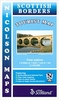

Scottish Borders County Street Atlas SPIRAL-BOUND
Scottish Borders Street Atlas in an A4 spiral-bound edition covering Biggar in the west to St Abb's Head in the east. Mapping shows street names clearly, with major roads highlighted with bold colouring; also displayed are postcode boundaries, car parks, railway and bus stations, post offices, schools, colleges, hospitals, police and fire stations, places of worship, leisure centres, footpaths and bridleways, camping and caravan sites, golf courses, and many other places of interest.The atlas index lists street names and postcodes, plus schools, hospitals, railway stations, shopping centres and other facilities.Current edition of this title was published in 2010.
Product Description
Reviews/Comments
Add New
Intelligent Comparison
Archived Product
Scottish Borders County Street Atlas POCKET Stanfords
£5.99
Archived Product
Somerset County Street Atlas SPIRAL-BOUND Stanfords
£11.99
Archived Product
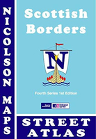
Scottish Borders Street Atlas Stanfords
£4.99
Archived Product
Gloucestershire County Street Atlas SPIRAL-BOUND SUPERCEDED Stanfords
£9.99
Archived Product
County Durham And Teesside County Street Atlas SPIRAL-BOUND Stanfords
£11.99
Vouchers
No voucher codes found.
Do you know a voucher code for this product or supplier? Add it to Insights for others to use.
Do you know a voucher code for this product or supplier? Add it to Insights for others to use.
 Denmark