More From Contributor

£6.99
The tranquil borderland of the Marches, offers a varied landscape truncated by rivers meandering to lowland plains. Limestone to the west & north of the old red sandstone of the Hereford Plain has given rise to exceptionally attractive hilly country with delightful, narrow valleys. In these 40 walks Ben Giles explores all the best places to visit in this wonderful area of the country. ...
Archived Product
£19.99
This is the 2012 edition of the most comprehensive guidebook to canoeing & kayaking the rivers of Wales. Nearly all the rivers of the principality are covered, mostly from navigable source to sea or confluence. From lazy gentle tours suitable for families, to raging torrents & waterfalls. There are over 180 rivers & two thousand kilometres of paddling. The book is simple to navigate with quick reference information, detailed descriptions & area maps of the river catchments. There are a great many more colour photographs in this new edition compared with the old. There`s also an eclectic mix of anecdotes for a perspective on the paddling scene in Wales, past & present
- but the best tales, yet to be told, are left for you to discover on the Welsh rivers. This is completely revised & updated since reprints of the first edition in 2003 & 2006. It has not been available since 2008 & there is no competitor or comparable book since the first edition.
...
Archived Product
£11.95
This is the 2010, 2nd edition of the full-colour handbook for walkers & runners in the Welsh 3000s traverse, the Paddy Buckley Round, The Snowdon Horseshoe, Snowdon Ascents & the Welsh 1000 metres race. Roy Clayton guides walkers through the route, while experienced fell runner, Ronald Turnbull, gives the necessary advice for runners, & for walkers who wish to step up the pace in the tradition of the greats like Joss Naylor, Eric Beard & Colin Donnelly. The original ” Welsh Three Thousand Foot Challenges” book has already been a success, with several reprints. This new edition

Includes::
up-to-date information with colour photographs & maps bringing the stunning mountain scenery to life. If you want to do the Welsh Three Thousands & you want to know how to train to do a fast time, or you just want to make sure you have a good chance of a successful completion, this book is the only choice.

...
Archived Product
£21.99
Wes Anderson is the most influential comedic voice from the past two decades of American cinema. A true auteur, his intimate involvement in each of his films; Bottle Rocket, Rushmore, The Royal Tenenbaums, The Life Aquatic with Steve Zissou, The Darjeeling Limited, Fantastic Mr. Fox & Moonrise Kingdom,

Includes::
scriptwriting, set design, soundtrack selections & unit photography. Anderson`s visual artistry, inimitable tone & idiosyncratic characterisations make each of his films instantly recognisable as ” Andersonian.” The Wes Anderson Collection is the first in-depth overview of Anderson`s work, guiding readers through the life & career of one of the most talked-about contemporary filmmakers. Previously unpublished photos, artwork & ephemera complement a book-length interview between Anderson & award-winning film critic Matt Zoller Seitz, who offers insights into Anderson`s creative process, influences, & the production of his films. These elements come together in a meticulously designed object in the spirit of Anderson`s movies: melancholy & playful, wise & childish--and thoroughly original.

...
Archived Product
£12.00
The West Country in the Landscapes of the Imagination guide series; providing an in-depth cultural & account of some of the world’s most memorable & evocative landscapes. Presented as a cultural & literary guide, each title in the series explores the cultural history of a landscape, providing an overview of the area’s development from its earliest roots to the modern day. Particular emphasis is placed on the literary, poetic, architectural, cultural & historical elements that make up the landscape & each title is written & researched by an academic expert. An Epilogue offers suggestion for further reading & indices of literary, artistic & historical names & places & landmarks. ...
Archived Product
£29.50
The West Country is a brand new cruising guide covering Lyme Bay to Land`s End & the Isles of Scilly. It provides essential sailing directions & detailed listings of facilities together with a wealth of information for those wishing to learn about the West Country & enjoy trips ashore. Part of the coastline has World Heritage Status & its geological history is described. Human settlement is traced & the reader is given guidance to find the oldest European fossil of modern man & numerous bronze age remains. Seahorses, dolphins, birds & flowers are discussed as is the history of the cream tea, which comes with a recipe for scones! People of significance, who were born or moved here, such as Sir Francis Drake, William Cookworthy & Agatha Christie, are also included, together with information on the atmospheric railway, the mining & fishing industry &, of course, the Cornish pasty. All the information relevant to a passage, harbour or anchorage is arranged for easy access. Aerial photographs have been taken by Patrick Roach. Ordnance Survey road maps & larger scale town plans help pinpoint facilities ashore. The West Country & Imray charts for the southwest of England provide a comprehensive package for all visitors arriving by boat. Carlos Rojas wrote Imray`s Cruising Galicia with Robert Bailey. Along with Imray & through his company Tucabo he has released marine apps for the iPhone & iPad, including Tides, Rules & Signals, Racing Rules, Boat Handling & Chart Navigation using Imray charts. ...
Archived Product
£3.50
The West End in 1870 in a fascinating series of reproductions of old Ordnance Survey plans in the Alan Godfrey Editions, ideal for anyone interested in the history of their neighbourhood or family. Three versions of this map have been published; each covers the same area of central London, stretching from Marble Arch eastward to Charing Cross Road, from Devonshire Street & Bedford Square southward to Berkeley Square & Haymarket. Oxford Street runs through the centre of the map & other streets include Regent Street, Shaftesbury Avenue, most of Tottenham Court Road, Charing Cross Road, Portland Place, Portman Square, Soho Square, Grosvenor Square, Cavendish Square & many others. Features include Burlington House, the National Gallery, British Museum, many theatres, All Soul`s church. Each map has selected extracts from directories. About the Alan Godfrey Editions of the 25” OS Series: Selected towns in Great Britain & Ireland are covered by maps showing the extent of urban development in the last decades of the 19th & early 20th century. The plans have been taken from the Ordnance Survey mapping & reprinted at about 15 inches to one mile (1:4, 340). On the reverse most maps have historical notes & many also include extracts from contemporary directories. Most maps cover about one mile (1.6kms) north/south, one & a half miles (2.4kms) across; adjoining sheets can be combined to provide wider coverage.FOR MORE INFORMATION & A COMPLETE LIST OF ALL AVAILABLE TITLES PLEASE CLICK ON THE SERIES LINK. ...
Archived Product
£3.50
The West End in 1894 in a fascinating series of reproductions of old Ordnance Survey plans in the Alan Godfrey Editions, ideal for anyone interested in the history of their neighbourhood or family. Three versions cover the same area of central London, stretching from Marble Arch eastward to Charing Cross Road, from Devonshire Street & Bedford Square southward to Berkeley Square & Haymarket. Oxford Street runs through the centre of the map & other streets include Regent Street, Shaftesbury Avenue, most of Tottenham Court Road, Charing Cross Road, Portland Place, Portman Square, Soho Square, Grosvenor Square, Cavendish Square, etc. Features include Burlington House, the National Gallery, British Museum, many theatres, All Soul`s church. Each map has selected extracts from directories. About the Alan Godfrey Editions of the 25” OS Series: Selected towns in Great Britain & Ireland are covered by maps showing the extent of urban development in the last decades of the 19th & early 20th century. The plans have been taken from the Ordnance Survey mapping & reprinted at about 15 inches to one mile (1:4, 340). On the reverse most maps have historical notes & many also include extracts from contemporary directories. Most maps cover about one mile (1.6kms) north/south, one & a half miles (2.4kms) across; adjoining sheets can be combined to provide wider coverage.FOR MORE INFORMATION & A COMPLETE LIST OF ALL AVAILABLE TITLES PLEASE CLICK ON THE SERIES LINK. ...
Archived Product
£3.50
The West End in 1914 in a fascinating series of reproductions of old Ordnance Survey plans in the Alan Godfrey Editions, ideal for anyone interested in the history of their neighbourhood or family. Three versions of this map each cover the same area of central London, stretching from Marble Arch eastward to Charing Cross Road, from Devonshire Street & Bedford Square southward to Berkeley Square & Haymarket. Oxford Street runs through the centre of the map & other streets include Regent Street, Shaftesbury Avenue, most of Tottenham Court Road, Charing Cross Road, Portland Place, Portman Square, Soho Square, Grosvenor Square, Cavendish Square & many others. Features include Burlington House, the National Gallery, British Museum, many theatres, All Soul`s church. Each map also has selected extracts from directories; the 1914 version has a directory for Oxford St. About the Alan Godfrey Editions of the 25” OS Series: Selected towns in Great Britain & Ireland are covered by maps showing the extent of urban development in the last decades of the 19th & early 20th century. The plans have been taken from the Ordnance Survey mapping & reprinted at about 15 inches to one mile (1:4, 340). On the reverse most maps have historical notes & many also include extracts from contemporary directories. Most maps cover about one mile (1.6kms) north/south, one & a half miles (2.4kms) across; adjoining sheets can be combined to provide wider coverage.FOR MORE INFORMATION & A COMPLETE LIST OF ALL AVAILABLE TITLES PLEASE CLICK ON THE SERIES LINK. ...
Archived Product
£16.99
The 95-mile West Highland Way was thought out in the 1960s & opened in 1980. But in a sense it has always been here. Clansmen & cattle thieves, redcoats & Sir Walter Scott in quest of a fictional character he called Rob Roy
- as well as Rob Roy himself, an honourable cattle thief
- have travelled this route between the Lowlands & Lochaber. This book traces the journey of glens & low passes, under the crags & high grassy sides of seven of Scotland`s hill ranges: from the Arrochar Alps of Loch Lomond to the Black Mount of Argyll, the Mamores & Ben Nevis. Along the way we see wild goats, the red deer of Rannoch, the golden eagle, & the meadow pipit. We enjoy violet orchids, wild heather & golden birches & walk through fields of yellow asphodel. Geologically, the West Highland Way is an outing from the Old Red Sandstone of the so-called Lowland Valley, through the grey schists of the Southern Highlands, to the great volcanic cauldron of Glen Coe. As it unfolds underfoot, it`s an ever-changing vista of heather & oakwood, of lochside & riverside
- but also a journey through the whole life & history of Celtic Scotl&.


...
Archived Product

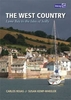
The West Country Folio 2600

Trevose Head to St David's Head including the River Severn A pack of 11 charts covering the Bristol Channel. The pack includes: 2600.1 Trevose Head to St David's Head 1:450, 000 2600.2 Padstow to Hartland Point 1:120, 000 2600.3 Hartland to Ilfracombe 1:130, 000 2600.4 Approaches to the Bristol Channel 1:130, 000 2600.5 Ilfracombe to Nash Point 1:130, 000 2600.6 Nash Point to Flat Holm 1:80, 000 2600.7 Flat Holm to Avonmouth 1:70, 000 2600.8 River Severn to Sharpness 1:50, 000 2600.9 River Avon 1:20, 000 2600.10 Tenby to Skomer Island 1:350, 000 2600.11 Milford Haven to River Cleddau 1:30, 000
RIP - This product is no longer available on our network. It was last seen on 25.09.2019

This page now acts as a permanent archive for this product. Add more information using the comments box below to ensure it can still be found by future generations.

Use our search facility to see if it is available from an alternative contributor.
  • Availability: Out Of Stock
  • Supplier: Stanfords
  • SKU: 9781846234095
Availability: In Stock
£37.50

Product Description

Trevose Head to St David's Head including the River Severn A pack of 11 charts covering the Bristol Channel. The pack
Includes:: 2600.1 Trevose Head to St David's Head 1:450, 000 2600.2 Padstow to Hartland Point 1:120, 000 2600.3 Hartland to Ilfracombe 1:130, 000 2600.4 Approaches to the Bristol Channel 1:130, 000 2600.5 Ilfracombe to Nash Point 1:130, 000 2600.6 Nash Point to Flat Holm 1:80, 000 2600.7 Flat Holm to Avonmouth 1:70, 000 2600.8 River Severn to Sharpness 1:50, 000 2600.9 River Avon 1:20, 000 2600.10 Tenby to Skomer Island 1:350, 000 2600.11 Milford Haven to River Cleddau 1:30, 000

Reviews/Comments

Add New

Intelligent Comparison

Oooops!
We couldn't find anything!
Perhaps this product's unique.... Or perhaps we are still looking for comparisons!
Click to bump this page and we'll hurry up.

Price History

Vouchers

No voucher codes found.
Do you know a voucher code for this product or supplier? Add it to Insights for others to use.

Facebook

Jargon Buster

Head - The upper part of a body typically separated by the neck.

Supplier Information

Stanfords
Stanfords was established in 1853 and opened their iconic Covent Garden flagship store in 1901. They have become the top retailer of maps, travel books and accessories in the UK and arguably offer the largest selection of maps and travel books worldwide. Famous names such as Captain Robert Falcon Scott, Ranulph Fiennes and Michael Palin have purchased from Stanfords. They now have a shop in Bristol and both stores together with other venues operate a calendar of events including talks, book signings and exhibitions. As a specialist map retailer, the map selection is comprehensive and includes road maps, street maps and walking maps from worldwide destinations, as well as a selection of world atlases and wall maps. Books include travel guides and travel literature. Stanfords also stock globes, from miniatures made of blue marble to magnificent floor-standing globes. The website features a selection of interesting articles on travel topics.
Page Updated: 2023-11-12 20:15:36

Community Generated Product Tags

Oh No! The productWIKI community hasn't generated any tags for this product yet!
Menu