More From Contributor
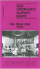
£11.95
This is the 2010, 2nd edition of the full-colour handbook for walkers & runners in the Welsh 3000s traverse, the Paddy Buckley Round, The Snowdon Horseshoe, Snowdon Ascents & the Welsh 1000 metres race. Roy Clayton guides walkers through the route, while experienced fell runner, Ronald Turnbull, gives the necessary advice for runners, & for walkers who wish to step up the pace in the tradition of the greats like Joss Naylor, Eric Beard & Colin Donnelly. The original ” Welsh Three Thousand Foot Challenges” book has already been a success, with several reprints. This new edition

Includes::
up-to-date information with colour photographs & maps bringing the stunning mountain scenery to life. If you want to do the Welsh Three Thousands & you want to know how to train to do a fast time, or you just want to make sure you have a good chance of a successful completion, this book is the only choice.

...
Archived Product
£21.99
Wes Anderson is the most influential comedic voice from the past two decades of American cinema. A true auteur, his intimate involvement in each of his films; Bottle Rocket, Rushmore, The Royal Tenenbaums, The Life Aquatic with Steve Zissou, The Darjeeling Limited, Fantastic Mr. Fox & Moonrise Kingdom,

Includes::
scriptwriting, set design, soundtrack selections & unit photography. Anderson`s visual artistry, inimitable tone & idiosyncratic characterisations make each of his films instantly recognisable as ” Andersonian.” The Wes Anderson Collection is the first in-depth overview of Anderson`s work, guiding readers through the life & career of one of the most talked-about contemporary filmmakers. Previously unpublished photos, artwork & ephemera complement a book-length interview between Anderson & award-winning film critic Matt Zoller Seitz, who offers insights into Anderson`s creative process, influences, & the production of his films. These elements come together in a meticulously designed object in the spirit of Anderson`s movies: melancholy & playful, wise & childish--and thoroughly original.

...
Archived Product
£12.00
The West Country in the Landscapes of the Imagination guide series; providing an in-depth cultural & account of some of the world’s most memorable & evocative landscapes. Presented as a cultural & literary guide, each title in the series explores the cultural history of a landscape, providing an overview of the area’s development from its earliest roots to the modern day. Particular emphasis is placed on the literary, poetic, architectural, cultural & historical elements that make up the landscape & each title is written & researched by an academic expert. An Epilogue offers suggestion for further reading & indices of literary, artistic & historical names & places & landmarks. ...
Archived Product
£37.50
Trevose Head to St David's Head including the River Severn A pack of 11 charts covering the Bristol Channel. The pack
Includes::
...
Archived Product
£29.50
The West Country is a brand new cruising guide covering Lyme Bay to Land`s End & the Isles of Scilly. It provides essential sailing directions & detailed listings of facilities together with a wealth of information for those wishing to learn about the West Country & enjoy trips ashore. Part of the coastline has World Heritage Status & its geological history is described. Human settlement is traced & the reader is given guidance to find the oldest European fossil of modern man & numerous bronze age remains. Seahorses, dolphins, birds & flowers are discussed as is the history of the cream tea, which comes with a recipe for scones! People of significance, who were born or moved here, such as Sir Francis Drake, William Cookworthy & Agatha Christie, are also included, together with information on the atmospheric railway, the mining & fishing industry &, of course, the Cornish pasty. All the information relevant to a passage, harbour or anchorage is arranged for easy access. Aerial photographs have been taken by Patrick Roach. Ordnance Survey road maps & larger scale town plans help pinpoint facilities ashore. The West Country & Imray charts for the southwest of England provide a comprehensive package for all visitors arriving by boat. Carlos Rojas wrote Imray`s Cruising Galicia with Robert Bailey. Along with Imray & through his company Tucabo he has released marine apps for the iPhone & iPad, including Tides, Rules & Signals, Racing Rules, Boat Handling & Chart Navigation using Imray charts. ...
Archived Product
£3.50
The West End in 1894 in a fascinating series of reproductions of old Ordnance Survey plans in the Alan Godfrey Editions, ideal for anyone interested in the history of their neighbourhood or family. Three versions cover the same area of central London, stretching from Marble Arch eastward to Charing Cross Road, from Devonshire Street & Bedford Square southward to Berkeley Square & Haymarket. Oxford Street runs through the centre of the map & other streets include Regent Street, Shaftesbury Avenue, most of Tottenham Court Road, Charing Cross Road, Portland Place, Portman Square, Soho Square, Grosvenor Square, Cavendish Square, etc. Features include Burlington House, the National Gallery, British Museum, many theatres, All Soul`s church. Each map has selected extracts from directories. About the Alan Godfrey Editions of the 25” OS Series: Selected towns in Great Britain & Ireland are covered by maps showing the extent of urban development in the last decades of the 19th & early 20th century. The plans have been taken from the Ordnance Survey mapping & reprinted at about 15 inches to one mile (1:4, 340). On the reverse most maps have historical notes & many also include extracts from contemporary directories. Most maps cover about one mile (1.6kms) north/south, one & a half miles (2.4kms) across; adjoining sheets can be combined to provide wider coverage.FOR MORE INFORMATION & A COMPLETE LIST OF ALL AVAILABLE TITLES PLEASE CLICK ON THE SERIES LINK. ...
Archived Product
£3.50
The West End in 1914 in a fascinating series of reproductions of old Ordnance Survey plans in the Alan Godfrey Editions, ideal for anyone interested in the history of their neighbourhood or family. Three versions of this map each cover the same area of central London, stretching from Marble Arch eastward to Charing Cross Road, from Devonshire Street & Bedford Square southward to Berkeley Square & Haymarket. Oxford Street runs through the centre of the map & other streets include Regent Street, Shaftesbury Avenue, most of Tottenham Court Road, Charing Cross Road, Portland Place, Portman Square, Soho Square, Grosvenor Square, Cavendish Square & many others. Features include Burlington House, the National Gallery, British Museum, many theatres, All Soul`s church. Each map also has selected extracts from directories; the 1914 version has a directory for Oxford St. About the Alan Godfrey Editions of the 25” OS Series: Selected towns in Great Britain & Ireland are covered by maps showing the extent of urban development in the last decades of the 19th & early 20th century. The plans have been taken from the Ordnance Survey mapping & reprinted at about 15 inches to one mile (1:4, 340). On the reverse most maps have historical notes & many also include extracts from contemporary directories. Most maps cover about one mile (1.6kms) north/south, one & a half miles (2.4kms) across; adjoining sheets can be combined to provide wider coverage.FOR MORE INFORMATION & A COMPLETE LIST OF ALL AVAILABLE TITLES PLEASE CLICK ON THE SERIES LINK. ...
Archived Product
£16.99
The 95-mile West Highland Way was thought out in the 1960s & opened in 1980. But in a sense it has always been here. Clansmen & cattle thieves, redcoats & Sir Walter Scott in quest of a fictional character he called Rob Roy
- as well as Rob Roy himself, an honourable cattle thief
- have travelled this route between the Lowlands & Lochaber. This book traces the journey of glens & low passes, under the crags & high grassy sides of seven of Scotland`s hill ranges: from the Arrochar Alps of Loch Lomond to the Black Mount of Argyll, the Mamores & Ben Nevis. Along the way we see wild goats, the red deer of Rannoch, the golden eagle, & the meadow pipit. We enjoy violet orchids, wild heather & golden birches & walk through fields of yellow asphodel. Geologically, the West Highland Way is an outing from the Old Red Sandstone of the so-called Lowland Valley, through the grey schists of the Southern Highlands, to the great volcanic cauldron of Glen Coe. As it unfolds underfoot, it`s an ever-changing vista of heather & oakwood, of lochside & riverside
- but also a journey through the whole life & history of Celtic Scotl&.


...
Archived Product
£9.50
The West Highland Way waterproof map from Footprint is a map-guide to the 95 mile (153km) route between Milngavie & Fort William. The mapping is based on Ordnance Survey data at a scale of 1:40, 000, with compact & concise information for walkers. ...
Archived Product
£14.95
A guidebook to Scotland`s West Highland Way, a 95-mile walk from Milngavie near Glasgow to Fort William, passing Loch Lomond, crossing Rannoch Moor & finishing in the shadow of Britain`s highest mountain. The walk, which takes roughly one week to complete, is described in seven stages, with each stage ranging from 8 to 20 miles. The guide details the `classic` south-north direction but also provides a summary description for those wanting to walk the route in the opposite direction. The guidebook, which features step-by-step route descriptions, 1:100K mapping, handy practical information as well as notes on the region`s history, culture & geography, is accompanied by a separate, pocket-sized 1:25K OS map booklet, providing all the mapping you need to walk the route. Passing from the lowlands to the highlands, the West Highland Way, which is one of Scotland`s Great Trails, showcases the splendour of glens flanked by great mountains, majestic moorland & sprawling farml&. It is the perfect adventure for distance walkers keen to discover the wild beauty of western Scotl&. ...
Archived Product

The West End 1870

The West End in 1870 in a fascinating series of reproductions of old Ordnance Survey plans in the Alan Godfrey Editions, ideal for anyone interested in the history of their neighbourhood or family. Three versions of this map have been published; each covers the same area of central London, stretching from Marble Arch eastward to Charing Cross Road, from Devonshire Street and Bedford Square southward to Berkeley Square and Haymarket. Oxford Street runs through the centre of the map and other streets include Regent Street, Shaftesbury Avenue, most of Tottenham Court Road, Charing Cross Road, Portland Place, Portman Square, Soho Square, Grosvenor Square, Cavendish Square and many others. Features include Burlington House, the National Gallery, British Museum, many theatres, All
Soul`s church. Each map has selected extracts from directories.About the Alan Godfrey Editions of the 25” OS Series:Selected towns in Great Britain and Ireland are covered by maps showing the extent of urban development in the last decades of the 19th and early 20th century. The plans have been taken from the Ordnance Survey mapping and reprinted at about 15 inches to one mile (1:4, 340). On the reverse most maps have historical notes and many also include extracts from contemporary directories. Most maps cover about one mile (1.6kms) north/south, one and a half miles (2.4kms) across; adjoining sheets can be combined to provide wider coverage.FOR MORE INFORMATION AND A COMPLETE LIST OF ALL AVAILABLE TITLES PLEASE CLICK ON THE SERIES LINK.
RIP - This product is no longer available on our network. It was last seen on 25.09.2019

This page now acts as a permanent archive for this product. Add more information using the comments box below to ensure it can still be found by future generations.

Use our search facility to see if it is available from an alternative contributor.
  • Availability: Out Of Stock
  • Supplier: Stanfords
  • SKU: 9780850541342
Availability: In Stock
£3.50

Product Description

The West End in 1870 in a fascinating series of reproductions of old Ordnance Survey plans in the Alan Godfrey Editions, ideal for anyone interested in the history of their neighbourhood or family. Three versions of this map have been published; each covers the same area of central London, stretching from Marble Arch eastward to Charing Cross Road, from Devonshire Street & Bedford Square southward to Berkeley Square & Haymarket. Oxford Street runs through the centre of the map & other streets include Regent Street, Shaftesbury Avenue, most of Tottenham Court Road, Charing Cross Road, Portland Place, Portman Square, Soho Square, Grosvenor Square, Cavendish Square & many others. Features include Burlington House, the National Gallery, British Museum, many theatres, All Soul`s church. Each map has selected extracts from directories. About the Alan Godfrey Editions of the 25” OS Series: Selected towns in Great Britain & Ireland are covered by maps showing the extent of urban development in the last decades of the 19th & early 20th century. The plans have been taken from the Ordnance Survey mapping & reprinted at about 15 inches to one mile (1:4, 340). On the reverse most maps have historical notes & many also include extracts from contemporary directories. Most maps cover about one mile (1.6kms) north/south, one & a half miles (2.4kms) across; adjoining sheets can be combined to provide wider coverage.FOR MORE INFORMATION & A COMPLETE LIST OF ALL AVAILABLE TITLES PLEASE CLICK ON THE SERIES LINK.

Reviews/Comments

Add New

Price History

Vouchers

No voucher codes found.
Do you know a voucher code for this product or supplier? Add it to Insights for others to use.

Facebook

Jargon Buster

Contemporary - Modern era design
Marble - A type of rock varying in colour. Commonly calcite or dolomite
Contemporary - A design reference to indicate post war modern design
History - Anything that happens in the past. An acedemic subject.
Road - a manmade lane or a path that is used to speed up travel.
Contemporary - An object that is living in the same time.
Museum - A building which exhibits old artefacts for viewing of people who show interest.
Ideal - Something that satisfies a perfect criteria.
Family - A group of people that live together made up from parents and children.

Supplier Information

Stanfords
Stanfords was established in 1853 and opened their iconic Covent Garden flagship store in 1901. They have become the top retailer of maps, travel books and accessories in the UK and arguably offer the largest selection of maps and travel books worldwide. Famous names such as Captain Robert Falcon Scott, Ranulph Fiennes and Michael Palin have purchased from Stanfords. They now have a shop in Bristol and both stores together with other venues operate a calendar of events including talks, book signings and exhibitions. As a specialist map retailer, the map selection is comprehensive and includes road maps, street maps and walking maps from worldwide destinations, as well as a selection of world atlases and wall maps. Books include travel guides and travel literature. Stanfords also stock globes, from miniatures made of blue marble to magnificent floor-standing globes. The website features a selection of interesting articles on travel topics.
Page Updated: 2023-11-12 20:15:36

Community Generated Product Tags

Oh No! The productWIKI community hasn't generated any tags for this product yet!
Menu