
 United Kingdom
 France
 Germany
 Netherlands
 Sweden
 USA
USA
 Italy
Italy
 Spain
Spain
More From Contributor


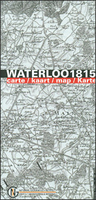
Waterloo 1815 Commemorative Map
Commemorative map from the Belgian national survey organization, NGI, published to mark the bicentenary of the battle of Waterloo in 1815, with present day mapping and reproductions of contemporary maps overprinted to indicate the movements of the French, British and Prussian forces.On one side is a current contoured topographic survey map at 1:50, 000 showing the area between Waterloo, Wavre, Gembloux, Fleurus and Nivelles. An overprint shows the movements of the French and the allied forces between 16th and 18th June, and also indicates sites of main battles and present day museums and information offices. The map is accompanied by notes describing the main events.On the reverse are six separate panels. A present day map at 1:250, 000 indicates troop movements across a slightly
larger area, extending south to Charleroi. Five panels present reproductions of mapping by cartographers William Blackwood and Sons showing in detail the dispositions of various army units at the battles of Quatre Bras and Ligny on 16th June, battle of Waterloo in the morning of 18th June and during its height, plus the battle of Wavre on 18th and 19th June.Map legend and all the text are in English, French, German and Dutch.
larger area, extending south to Charleroi. Five panels present reproductions of mapping by cartographers William Blackwood and Sons showing in detail the dispositions of various army units at the battles of Quatre Bras and Ligny on 16th June, battle of Waterloo in the morning of 18th June and during its height, plus the battle of Wavre on 18th and 19th June.Map legend and all the text are in English, French, German and Dutch.

Product Description
Reviews/Comments
Add New
Vouchers
No voucher codes found.
Do you know a voucher code for this product or supplier? Add it to Insights for others to use.
Do you know a voucher code for this product or supplier? Add it to Insights for others to use.
 Denmark