
 United Kingdom
 France
 Germany
 Netherlands
 Sweden
 USA
USA
 Italy
Italy
 Spain
Spain
More From Contributor


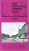
Waterloo And Seaforth 1925
Waterloo and Seaforth in 1925 in a fascinating series of reproductions of old Ordnance Survey plans in the Alan Godfrey Editions, ideal for anyone interested in the history of their neighbourhood or family. Selected towns in Great Britain and Ireland are covered by maps showing the extent of urban development in the last decades of the 19th and early 20th century.In this title: the map covers Waterloo, a few miles north of Liverpool, plus the northern part of Seaforth and western part of Litherland. Coverage stretches from Milton Road southward to Clarement Road, and from the coast inland to Litherland Park. Features include Waterloo Park, Seaforth Barracks, Lewlithia Park, railway with station, Christ Church, Marine Terrace Green, tramways, Leeds & Liverpool Canal, Litherland
Tannery, Sefton Tannery, sugar refinery, Diamond Laundry, etc. On the reverse is sheet 98.12 which extends coverage eastward to include the Oxford Drive area, plus a section of the railway timetable for the Crossens-Southport-Liverpool service in 1929.About the Alan Godfrey Editions of the 25
Tannery, Sefton Tannery, sugar refinery, Diamond Laundry, etc. On the reverse is sheet 98.12 which extends coverage eastward to include the Oxford Drive area, plus a section of the railway timetable for the Crossens-Southport-Liverpool service in 1929.About the Alan Godfrey Editions of the 25
Product Description
Reviews/Comments
Add New
Intelligent Comparison
Archived Product

Waterloo And Seaforth 1925 Stanfords
£3.50
Archived Product
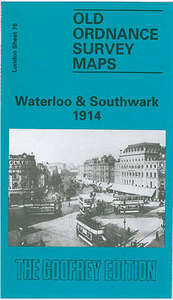
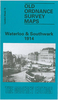
Waterloo And Southwark 1914 Stanfords
£3.50
Archived Product
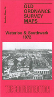
Waterloo And Southwark 1872 Stanfords
£3.50
Archived Product

Waterloo And Southwark 1894 Stanfords
£3.50
Vouchers
No voucher codes found.
Do you know a voucher code for this product or supplier? Add it to Insights for others to use.
Do you know a voucher code for this product or supplier? Add it to Insights for others to use.
 Denmark