
 United Kingdom
 France
 Germany
 Netherlands
 Sweden
 USA
USA
 Italy
Italy
 Spain
Spain
More From Contributor


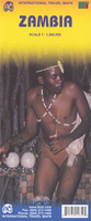
Zambia ITMB
Indexed road map of Zambia with street plans of central Lusaka and Livingstone. Altitude colouring with elevation in feet shows the topography, indicating wetlands and swamp areas. The map shows the country’s rail and road networks, with driving distances on main routes and locations of fuel supplies.National parks are prominently marked and symbols highlight locations with tourist accommodation, campsites, various places of interest, archaeological sites, local airfields, etc. The map is indexed and has a latitude/longitude grid at intervals of 1º.Street plans of central areas of Lusaka and Livingstone show various public buildings, selected accommodation, rail and bus terminals, embassies, etc.

Product Description
Reviews/Comments
Add New
Vouchers
No voucher codes found.
Do you know a voucher code for this product or supplier? Add it to Insights for others to use.
Do you know a voucher code for this product or supplier? Add it to Insights for others to use.
 Denmark